Kibyra ancient city was founded on low hills,
heights of which differ from 950 m and 1350 m,
to the West of Burdur, in Gölhisar. The city was at the junction of
Lycian, Karian and Phrygian cultural areas and in the center of a trade route
connecting the North to the South and the East to the West in early periods.
The area was called as ‘Kabalia’ in early periods and ‘Kibyratis’ during
Hellenistic and Roman periods. Although the meaning of the word is not known
exactly, Kibyra is not a Hellenistic name. Common view is that it belonged to a
language used by Luvians, people who lived in western and southwestern Anatolia
during the Late Bronze Age, and this unknown name was changed as Kibyra in
Hellen. According to Strabo, a traveller from Anatolia, Kibyrians were of
Lydian origin and they moved to Kabalis from there. It is also obvious that
there were also migrations from Pisidia, Milyas and Solym to the area and all
these people joined and established Kibyra, the width of
which reached to 100 stadia. Strabo also emphasized that four different
languages, Lydian, Solymi, Psidian, Hellenic, were spoken in the city. Strabo’s
description about the foundation of the city has been supported by the
archaeological finds from Uylupınar, a settlement approximately 18 km away from
Kibyra. The settlement around Uylupınar village of Gölhisar and the rocky area
around Gölhisar Lake has finds dating back to the Early Iron Age. This
settlement is most probably the area where Kibyrians had
settled long before they moved to the city, which can be seen today, in other
words ‘Old Kibyra’. Old architectural ruins of the city today are from the
Roman Imperial Period and Late Antiguity.

Kibyra was an autonomous city which could coin its
own money during the Hellenistic Period.
It is known that the quadruple council
(Kabalis Tetrapolis / Association of Four Cities in Kabalis Region)
which was established in the second century BC under the leadership of Kibyra
and consisted of Bubon, Balboura and Oinoanda, cities located nearby, played an
important role in the political history of the area. It seems that the council
was a decision making mechanism based on voting of city representatives. In this political association, Kibyra had two
votes, whereas the other cities had one vote each. According to Strabo, Kibyra
had two votes for providing 30.0000 infantry and 2000 cavalry. Records show
that the council was eliminated by Roman commander Murena in 82 BC. After this
period, Kibyra was incorporated into Asia Minor and the other cities were
incorporated into the Lycian League. During the Roman Period, it became the
judicial centre of Asia Minor’s state governor.
The city, destroyed by an earthquake in 23 AD, was
exempted from tax for five years and it was donated money by Roman Emperor
Tiberius. Thus, the city was rebuilt and Kbyrians showed their gratitude by
naming their city as ‘Caesera Kibyra’. After the second devastating eartquake
in 417 AD, the city lost its architectural plan and continued its existence
getting smaller and losing its glory during Late Antiguity.
Kibyra main city is on three hills seperated from
each other by deep cliffs. It is seen that public, civil and religious
buildings were organized symmetrically to form completeness. All the buildings
were placed on the terraced hill so as not to spoil each other’s lake and
valley view.
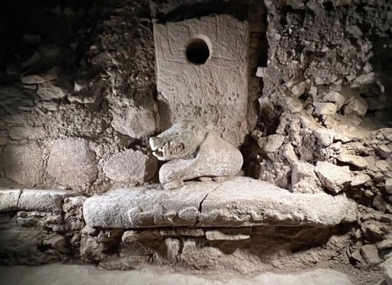
Necropolis, consisting of many different
architectural styles, surrounds the hill where public buildings are seen
densely. These buildings are dense between the Stadion in the East and the West
ridge of the hill where the Theatre and the Odeon are. On
the same axis, main street, secondary routes, basilica with administrative and
judicial functions, temples, social and commercial market place (Agora),
temples and small shops, symbols of economical liveliness of the city, can be
seen. According to the records and inscriptions, Kibyra was famous for its
ironworking, leather trade and horse breeding. It has also been found out that
ceramic fabrication was of great importance in Kibyra.
Excavation and research studies in Kibyra, under
the leadership of the Burdur Museum, started in 2006. It has been a continuous
excavation by the decision of the Council of Ministers on behalf of Mehmet Akif
Ersoy University headed by Associate Professor Şükrü Özdoğru since 2010. Since 2006, Stadion, Odeion (Music House), Agora,
Necropolis, Late Antiguity Bath, Caiserion, Roman Imperial Bath and Basilica
have been excavated. Stadion, Odeion and Bath
excavations have been completed. Work continues in Agora, Main Street,
Necropolis, Caisarion, Basilica and the Bath Complex from the Roman Imperial
Period.